This page requires that JavaScript be enabled in your browser.
Learn how »
Datos geográficos en Wolfram Language
Mathematica 10 introdujo una nueva área de conocimiento a Wolfram Language: la visualización y datos geográficos, una extensión de su potente funcionalidad gráfica para crear mapas. En esta presentación nos centraremos en la gran cantidad de información incorporada en Wolfram Language, y la representación y visualización de datos utilizando algunas de las nuevas funciones de Geographics.
Thanks for your feedback.
Channels: Virtual Events
701 videos match your search.
 |
|
 |
|
 |
|
 |
|
 |
|
 |
|
 |
|
 |
|
 |
|
 |
|
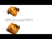 |
See new capabilities for directly printing 3D models on standard printers or through online printing services. Print exactly the model you want, using the vast collection of curated models and ... |
 |
|
 |
|
 |
|
 |
|
 |
|
 |
|
 |
|
 |
|
 |
Yu-Sung Chang The Wolfram Computable Document Format (CDF) provides a new streamlined way for creating dynamic educational content. This course from the Wolfram Mathematica Virtual Conference 2012 shows how to use CDF for ... |