"GeographicRegion" Polygons
A new geo entity domain, "GeographicRegion", can describe whole continents and other types of geographic entities.
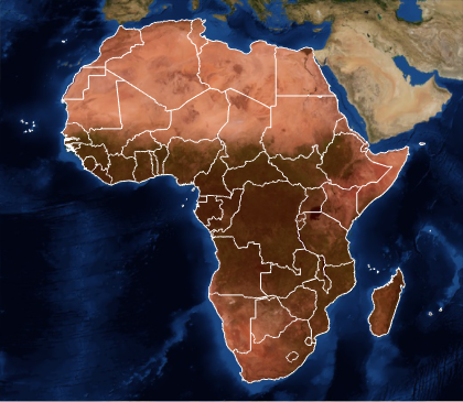
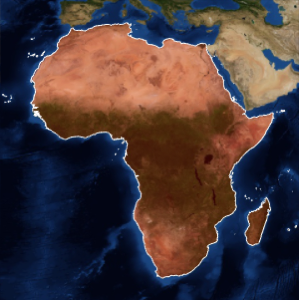
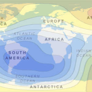
Africa as a geographic region entity represents the whole continent.
In[1]:=
africa = EntityValue[Entity["GeographicRegion", "Africa"],
  EntityProperty["GeographicRegion", "Polygon"]]
Out[1]=
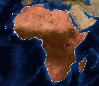
In[2]:=
GeoGraphics[{EdgeForm[White], FaceForm[Red], africa},
 GeoBackground -> "Satellite"]
Out[2]=
It is also possible to obtain the polygons of all countries in Africa.
In[3]:=
africacountries =
  EntityValue[Entity["GeographicRegion", "Africa"],
   EntityProperty["GeographicRegion", "PolygonCountryBoundaries"]];
In[4]:=
GeoGraphics[{EdgeForm[White], FaceForm[Red], africacountries},
 GeoBackground -> "Satellite"]
Out[4]=