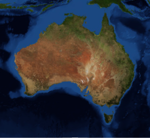
New "Country" Polygons
Version 11 contains fully updated data for all country polygons, in several geo variants, to include or not smaller islands or overseas territories.
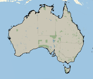
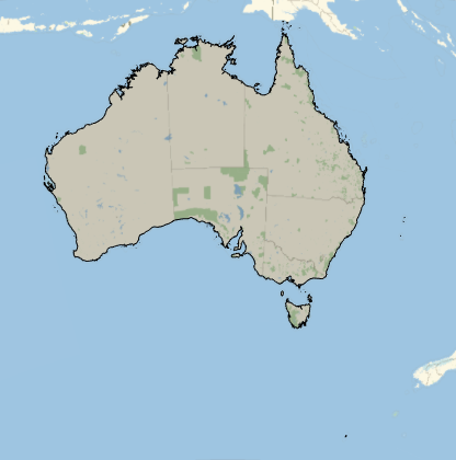
Take the polygon of Australia and highlight its boundary in black. Choose the "PrincipalArea" geo variant to include more islands.
In[1]:=
GeoGraphics[{EdgeForm[Black],
  Polygon[GeoVariant[Entity["Country", "Australia"],
    "PrincipalArea"]]}]
Out[1]=
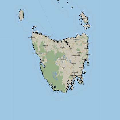
Zoom in to show the details of the coasts of the Tasmanian islands.
In[2]:=
GeoGraphics[{EdgeForm[Black],
  Polygon[GeoVariant[Entity["Country", "Australia"],
    "PrincipalArea"]]}];
Show[%, GeoCenter -> Entity["Island", "TasmaniaMainIsland"],
 GeoRange -> Quantity[200, "Miles"]]
Out[2]=