Новое в системе Wolfram
Mathematica
9
◄
предыдущая
|
следующая
►
Новое в системе Wolfram
Mathematica
9
›
Поддержка полного спектра интернет-доступа
Интерактивный доступ к интернету
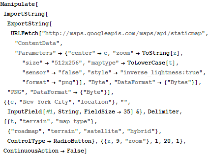
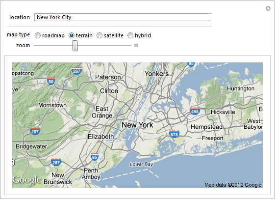
Интерактивное получение картографических данных, используя веб API.
In[1]:=
X
Manipulate[ ImportString[ ExportString[ URLFetch["http://maps.googleapis.com/maps/api/staticmap", "ContentData", "Parameters" -> {"center" -> c, "zoom" -> ToString[z], "size" -> "512x256", "maptype" -> ToLowerCase[t], "sensor" -> "false", "style" -> "inverse_lightness:true", "format" -> "png"}], "Byte", "DataFormat" -> {"Bytes"}], "PNG", "DataFormat" -> {"Byte"}], {{c, "New York City", "location"}, "", InputField[#1, String, FieldSize -> 35] &}, Delimiter, {{t, "terrain", "map type"}, {"roadmap", "terrain", "satellite", "hybrid"}, ControlType -> RadioButton}, {{z, 9, "zoom"}, 1, 20, 1}, ContinuousAction -> False]
Out[1]=