New in Wolfram
Mathematica
7: Integrated Geodesy & GIS
◄
previous
|
next
►
Import GIS Files
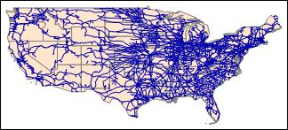
State borders and rail network layers of the US, imported from a shapefile.
In[1]:=
Import["http://exampledata.wolfram.com/usamap.zip",

 ImageSize -> Medium]
Out[1]=