地理情報の可視化
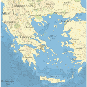
The Wolfram Language introduces GeoGraphics, an extension of its powerful graphical functionality to produce maps. GeoGraphics offers full automation and freedom to handle cartographic projections, choice of zoom (from the whole Earth down to meter scale), map styling (street maps, relief maps, ...), and much more. GeoGraphics introduces new geographical elements adapted to the surface of the Earth (like geodesics or rhumb lines for navigation) and has integrated access to the large corpus of geographical information in Wolfram|Alpha through the new Entity framework.
- Wolfram言語のGraphicsパラダイムの拡張であるGeoGraphicsを使うことによる,地図に対するパワフルで簡単な統合されたアプローチ
- GeoPath(測地線,航程線,平行線等),GeoDisk,GeoVisibleRegion等の新しい地理的プリミティブ.DayHemisphere,DayNightTerminator等の新しい時間関連のプリミティブ.
- Wolfram言語のGraphics機能,画像処理,測地学計算,統計解析の統合と, Wolfram|Alphaの巨大な情報へのEntityフレームワークを介したアクセス
- 球地球モデルおよび楕円地球モデルの両方に対する標準的な地図投影法と座標系のサポート.lat, lon 座標および投影された座標の統合された同時使用
- 座標範囲とズームレベルの選択が完全に自動化された,Wolfram|Alphaサーバからの地図背景のリアルタイムの取得
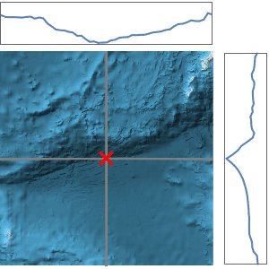
- 2DのGeoGraphicsマップ表現を補足する,世界中のどの地域の標高データも,どの経路に沿った標高データもダウンロード可能.標高に基づいた起伏地図や地形図の作成も可能
Related Examples
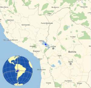 Show the Global Context of a Local Map »
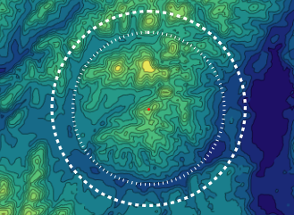
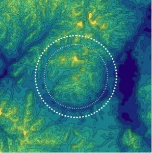 Map the Wembo-Nyama Ring Structure »
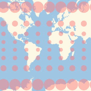 Show Map Distortion with Tissot's Indicatrix »
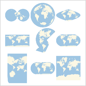 Use Any Map Projection »
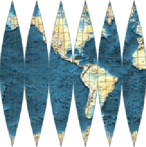 Make a Map That Wraps a Globe »
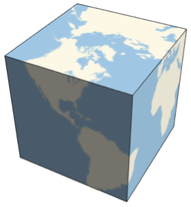 Make a Cubic Earth »
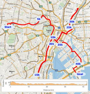 Plot the Course of the Tokyo Marathon »
 Plot the Paths of Shadows Cast by the Sun »
関連関数DayHemisphere  DayNightTerminator Entity EntityValue GeoBackground GeoBoundingBox GeoBounds GeoCenter GeoCircle GeoDisk GeoGraphics GeoGridLines GeoMarker GeoModel GeoPath GeoProjection GeoRange GeoRangePadding GeoScaleBar GeoVisibleRegion GeoVisibleRegionBoundary GeoZoomLevel NightHemisphere
DayNightTerminator Entity EntityValue GeoBackground GeoBoundingBox GeoBounds GeoCenter GeoCircle GeoDisk GeoGraphics GeoGridLines GeoMarker GeoModel GeoPath GeoProjection GeoRange GeoRangePadding GeoScaleBar GeoVisibleRegion GeoVisibleRegionBoundary GeoZoomLevel NightHemisphere10の新機能の関連項目


