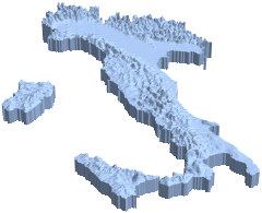
GeoElevation-Modelle in 3D
Erstellen Sie ein Höhenmodell eines Landes.
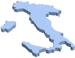
In[1]:=
country =
 GeoElevationData[Entity["Country", "Italy"], Automatic, "Region"]
Out[1]=
Skalieren Sie die Werte in vertikale Richtung, um das Höhenrelief zu verstärken.
In[2]:=
{xrange, yrange, {zmin, zmax}} = RegionBounds[country]Out[2]=
In[3]:=
Show[RegionResize[country, {xrange, yrange, {0, 300 zmax}}],
 PlotRange -> {xrange, yrange, {265 zmax, 300 zmax}}]
Out[3]=