Connectivity of US Counties
Construct the connectivity graph between neighboring US counties.
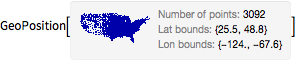
Take the list of all counties in the contiguous continental US states.
In[1]:=
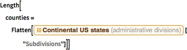
Length[counties =
  Flatten[EntityClass["AdministrativeDivision",
     "ContinentalUSStates"]["Subdivisions"]]]
Out[1]=
Add the District of Columbia, which is not a subdivision of any of the 48 contiguous states.
In[2]:=
AppendTo[counties,
  Entity["AdministrativeDivision", {"DistrictOfColumbia",
    "DistrictOfColumbia", "UnitedStates"}]];
Compute the list of counties bordering each county.
In[3]:=
bordering = EntityValue[counties, "BorderingCounties"];Discard some cases for which bordering information is not available.
In[4]:=
Length[missingpos = Position[bordering, _Missing]]Out[4]=
In[5]:=
counties = Delete[counties, missingpos];
bordering = Delete[bordering, missingpos];
Construct the edges of the connectivity graph of the US counties.
In[6]:=
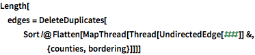
Length[edges =
  DeleteDuplicates[
   Sort /@ Flatten[
     MapThread[Thread[UndirectedEdge[##]] &, {counties, bordering}]]]]
Out[6]=
In[7]:=
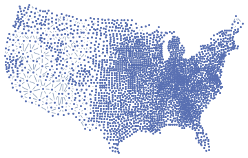
Graph[counties, edges]Out[7]=
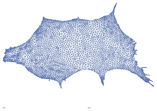
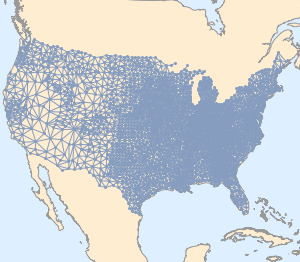
To construct a more familiar embedding, download the center position of all counties.
In[8]:=
pos = GeoPosition[EntityValue[counties, "Position"]]Out[8]=
Use the following cartographic projection.
In[9]:=
proj = {"LambertAzimuthal",
   "Centering" ->
    Entity["City", {"Topeka", "Kansas", "UnitedStates"}]};
In[10]:=
projpos = First@GeoGridPosition[pos, proj];Then you have the following graph embedding.
In[11]:=
graph = Graph[counties, edges, VertexCoordinates -> projpos]Out[11]=
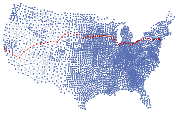
To go from the county of San Francisco to Manhattan, you need to visit at least 67 counties, including the initial and final ones.
In[12]:=
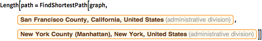
Length[path = FindShortestPath[graph,
   Entity[
    "AdministrativeDivision", {"SanFranciscoCounty", "California",
     "UnitedStates"}],
   Entity[
    "AdministrativeDivision", {"NewYorkCounty", "NewYork",
     "UnitedStates"}]]]
Out[12]=
In[13]:=
HighlightGraph[graph, PathGraph[path]]Out[13]=