创建动物目击地的应用程序
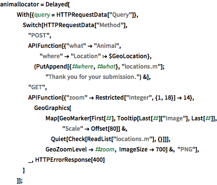
RESTful API 使用相同的 URL,但响应不同,具体取决于HTTP方法. GenerateHTTPResponse 以递归方式工作,所以一个 Delayed 计算会返回不同的 APIFunction 实例以处理不同的 HTTP 方法,从而实现一个位置报告的 Web 应用程序.
创建一个简单的应用程序,收集发现不同类型动物的位置.
In[1]:=

animallocator = Delayed[
   With[{query = HTTPRequestData["Query"]},
    Switch[HTTPRequestData["Method"],
     "POST",
     APIFunction[{"what" -> "Animal",
       "where" -> "Location" :> $GeoLocation},
      (PutAppend[{#where, #what}, "locations.m"];
        "Thank you for your submission.") &],
     "GET",
     APIFunction[{"zoom" -> Restricted["Integer", {1, 18}] -> 14},
      GeoGraphics[
        Map[GeoMarker[First[#], Tooltip[Last[#]["Image"], Last[#]],
           "Scale" -> Offset[80]] &,
         Quiet[Check[ReadList["locations.m"], {}]]],
        GeoZoomLevel -> #zoom, ImageSize -> 700] &, "PNG"],
     _, HTTPErrorResponse[400]
     ]
    ]];
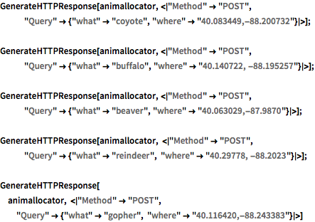
模拟一些动物的目击报告.
In[2]:=

GenerateHTTPResponse[
  animallocator, <|"Method" -> "POST",
   "Query" -> {"what" -> "coyote", "where" -> "40.083449,-88.200732"}|>];
GenerateHTTPResponse[
  animallocator, <|"Method" -> "POST",
   "Query" -> {"what" -> "buffalo",
     "where" -> "40.140722, -88.195257"}|>];
GenerateHTTPResponse[
  animallocator, <|"Method" -> "POST",
   "Query" -> {"what" -> "beaver", "where" -> "40.063029,-87.9870"}|>];
GenerateHTTPResponse[
  animallocator, <|"Method" -> "POST",
   "Query" -> {"what" -> "reindeer", "where" -> "40.29778, -88.2023"}|>];
GenerateHTTPResponse[animallocator, <|"Method" -> "POST",
  "Query" -> {"what" -> "gopher", "where" -> "40.116420,-88.243383"}|>]
Out[2]=
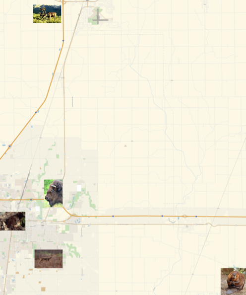
模拟提取结果.
In[3]:=
ImportString[GenerateHTTPResponse[animallocator]["Body"], "PNG"]Out[3]=


