地理的な場所の格子
新関数のCoordinateBoundsArrayとCoordinateBoundingBoxArrayを使って,指定された刻み幅の多次元数値配列を作ることができる.
アメリカ合衆国の経緯度の境界を計算する.
In[1]:=
{lat, lon} = GeoBounds[Entity["Country", "UnitedStates"]]Out[1]=
そこから,刻み幅が2度の座標の配列を生成する.
In[2]:=
arr = CoordinateBoundsArray[QuantityMagnitude@{lon, lat}, 2];配列から地理格子を作成する.
In[3]:=
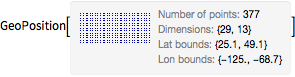
grid = GeoGridPosition[arr, "Equirectangular"];In[4]:=
pos = GeoPosition[grid]Out[4]=
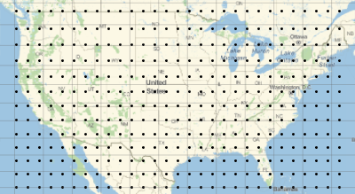
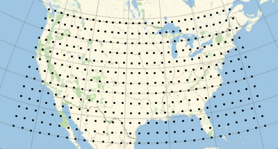
地図上にその座標をプロットする.
In[5]:=
graphics = GeoGraphics[Point[pos], GeoGridLines -> Automatic]Out[5]=
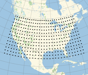
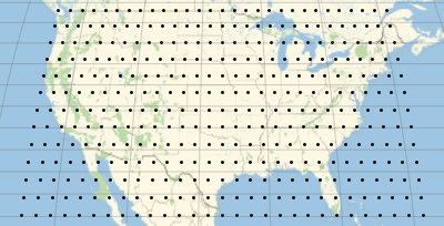
他の投影法で点をプロットする.
In[6]:=
Show[graphics, GeoProjection -> "Mollweide"]Out[6]=
In[7]:=
Show[graphics, GeoProjection -> "Mercator"]Out[7]=