「HistoricalCountry」多角形
新しい地理実体領域"HistoricalCountry"は多様な歴史的実体についての便利なデータを提供する.
ローマ帝国の存続期間.
In[1]:=
Entity["HistoricalCountry",
  "RomanEmpire"][{EntityProperty["HistoricalCountry", "StartDate"],
  EntityProperty["HistoricalCountry", "EndDate"]}]
Out[1]=
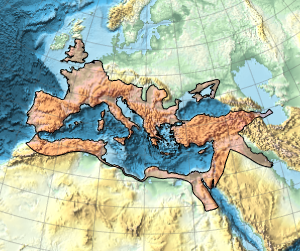
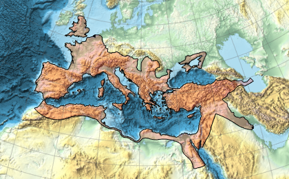
最大であったときのローマ帝国の領土.
In[2]:=
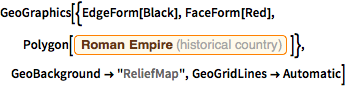
GeoGraphics[{EdgeForm[Black], FaceForm[Red],
  Polygon[Entity["HistoricalCountry", "RomanEmpire"]]},
 GeoBackground -> "ReliefMap", GeoGridLines -> Automatic]
Out[2]=
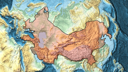
次はモンゴル帝国の存続期間と,最大であったときの領土である.
In[3]:=
Entity["HistoricalCountry",
  "MongolEmpire"][{EntityProperty["HistoricalCountry", "StartDate"],
  EntityProperty["HistoricalCountry", "EndDate"]}]
Out[3]=
In[4]:=
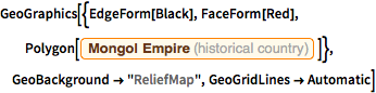
GeoGraphics[{EdgeForm[Black], FaceForm[Red],
  Polygon[Entity["HistoricalCountry", "MongolEmpire"]]},
 GeoBackground -> "ReliefMap", GeoGridLines -> Automatic]
Out[4]=