"HistoricalCountry" 다각형
새로운 지리 실체 영역 "HistoricalCountry"는 다양한 역사적 실체에 대한 유용한 데이터를 제공합니다.
로마 제국의 존속 기간을 알아봅니다.
In[1]:=
Entity["HistoricalCountry",
  "RomanEmpire"][{EntityProperty["HistoricalCountry", "StartDate"],
  EntityProperty["HistoricalCountry", "EndDate"]}]
Out[1]=
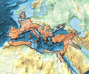
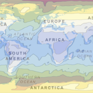
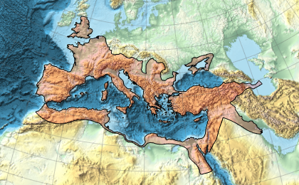
다음은 로마 제국이 가진 지리적 최대의 영토를 나타냅니다.
In[2]:=
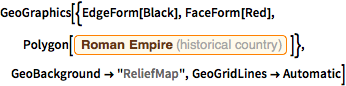
GeoGraphics[{EdgeForm[Black], FaceForm[Red],
  Polygon[Entity["HistoricalCountry", "RomanEmpire"]]},
 GeoBackground -> "ReliefMap", GeoGridLines -> Automatic]
Out[2]=
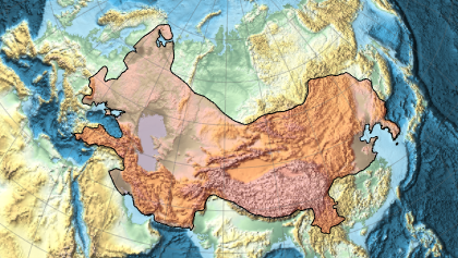
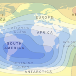
다음은 몽골 제국의 존속 기간과 최대의 영토를 표시합니다.
In[3]:=
Entity["HistoricalCountry",
  "MongolEmpire"][{EntityProperty["HistoricalCountry", "StartDate"],
  EntityProperty["HistoricalCountry", "EndDate"]}]
Out[3]=
In[4]:=
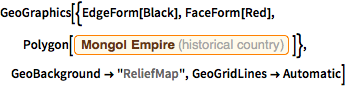
GeoGraphics[{EdgeForm[Black], FaceForm[Red],
  Polygon[Entity["HistoricalCountry", "MongolEmpire"]]},
 GeoBackground -> "ReliefMap", GeoGridLines -> Automatic]
Out[4]=