Polígonos com "HistoricalCountry"
O novo domínio de entidade geográfica "HistoricalCountry" fornece dados úteis sobre uma grande conjunto de entidades históricas.
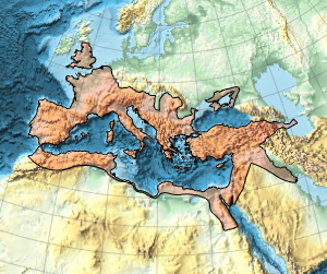
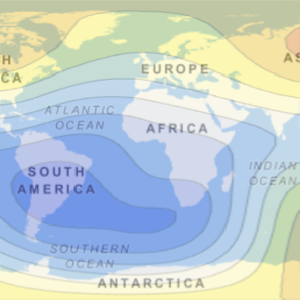
Extensão durante o tempo do Império Romano.
In[1]:=
Entity["HistoricalCountry",
  "RomanEmpire"][{EntityProperty["HistoricalCountry", "StartDate"],
  EntityProperty["HistoricalCountry", "EndDate"]}]
Out[1]=
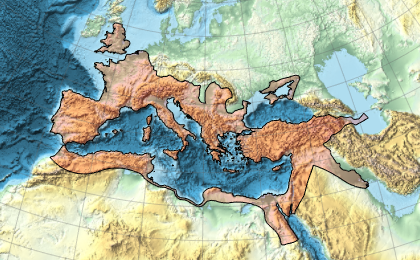
Esta é a extensão geográfica máxima do Império Romano.
In[2]:=
GeoGraphics[{EdgeForm[Black], FaceForm[Red],
  Polygon[Entity["HistoricalCountry", "RomanEmpire"]]},
 GeoBackground -> "ReliefMap", GeoGridLines -> Automatic]
Out[2]=
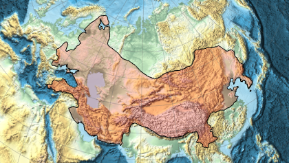
E esta é a extensão máxima do Império Mongol.
In[3]:=
Entity["HistoricalCountry",
  "MongolEmpire"][{EntityProperty["HistoricalCountry", "StartDate"],
  EntityProperty["HistoricalCountry", "EndDate"]}]
Out[3]=
In[4]:=
GeoGraphics[{EdgeForm[Black], FaceForm[Red],
  Polygon[Entity["HistoricalCountry", "MongolEmpire"]]},
 GeoBackground -> "ReliefMap", GeoGridLines -> Automatic]
Out[4]=