地理可视化
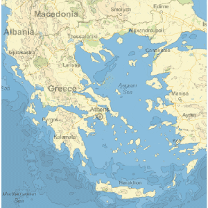
The Wolfram Language introduces GeoGraphics, an extension of its powerful graphical functionality to produce maps. GeoGraphics offers full automation and freedom to handle cartographic projections, choice of zoom (from the whole Earth down to meter scale), map styling (street maps, relief maps, ...), and much more. GeoGraphics introduces new geographical elements adapted to the surface of the Earth (like geodesics or rhumb lines for navigation) and has integrated access to the large corpus of geographical information in Wolfram|Alpha through the new Entity framework.
- 通过使用 GeoGraphics 所获得的强大、简易和统一的地图,是 Wolfram 语言 Graphics 的成功扩展范例.
- 新的地理学基元,如:GeoPath(测地线、方位线、平行线等)、GeoDisk 和 GeoVisibleRegion,以及新的实践感知基元,如:DayHemisphere 和 DayNightTerminator.
- 整合 Wolfram 语言的 Graphics 功能、图像处理、测地学计算、统计分析,以及通过新型 Entity 框架对 Wolfram|Alpha 中的大型信息语料库的访问.
- 支持球形和椭圆形地球模型的标准地图投影和坐标系统. 集成并同时使用 lat、lon 坐标和投射坐标.
- 从 Wolfram|Alpha 服务器对地图背景进行实时检索,支持坐标范围和缩放等级的完全自动选择.
- 从任何世界区域和沿任何路径下载高程数据,补充二维 GeoGraphics 地图表现. 根据高程创建地形或等高线图.
Related Examples
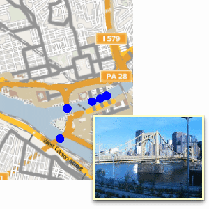
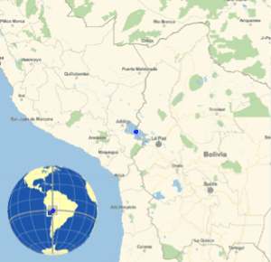 Show the Global Context of a Local Map »
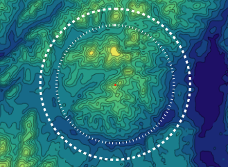
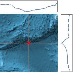
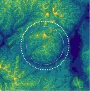 Map the Wembo-Nyama Ring Structure »
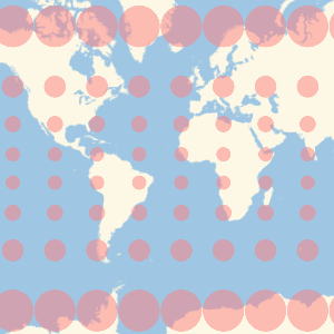 Show Map Distortion with Tissot's Indicatrix »
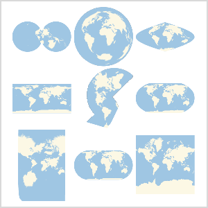 Use Any Map Projection »
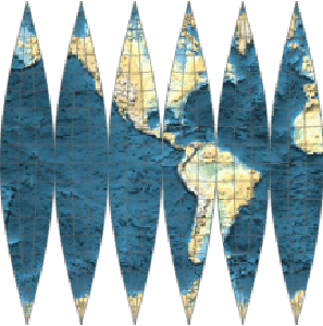 Make a Map That Wraps a Globe »
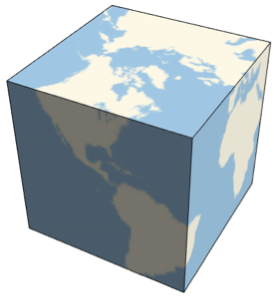 Make a Cubic Earth »
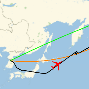
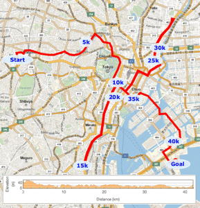 Plot the Course of the Tokyo Marathon »
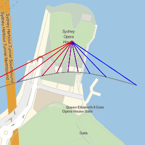 Plot the Paths of Shadows Cast by the Sun »
相关函数DayHemisphere  DayNightTerminator Entity EntityValue GeoBackground GeoBoundingBox GeoBounds GeoCenter GeoCircle GeoDisk GeoGraphics GeoGridLines GeoMarker GeoModel GeoPath GeoProjection GeoRange GeoRangePadding GeoScaleBar GeoVisibleRegion GeoVisibleRegionBoundary GeoZoomLevel NightHemisphere
DayNightTerminator Entity EntityValue GeoBackground GeoBoundingBox GeoBounds GeoCenter GeoCircle GeoDisk GeoGraphics GeoGridLines GeoMarker GeoModel GeoPath GeoProjection GeoRange GeoRangePadding GeoScaleBar GeoVisibleRegion GeoVisibleRegionBoundary GeoZoomLevel NightHemisphere相关指南
相关链接
DayHemisphere DayNightTerminator Entity EntityValue GeoBackground GeoBoundingBox GeoBounds GeoCenter GeoCircle GeoDisk GeoGraphics GeoGridLines GeoMarker GeoModel GeoPath GeoProjection GeoRange GeoRangePadding GeoScaleBar GeoVisibleRegion GeoVisibleRegionBoundary GeoZoomLevel NightHemisphere DayHemisphere DayNightTerminator Entity EntityValue GeoBackground GeoBoundingBox GeoBounds GeoCenter GeoCircle GeoDisk GeoGraphics GeoGridLines GeoMarker GeoModel GeoPath GeoProjection GeoRange GeoRangePadding GeoScaleBar GeoVisibleRegion GeoVisibleRegionBoundary GeoZoomLevel NightHemisphere
DayNightTerminator Entity EntityValue GeoBackground GeoBoundingBox GeoBounds GeoCenter GeoCircle GeoDisk GeoGraphics GeoGridLines GeoMarker GeoModel GeoPath GeoProjection GeoRange GeoRangePadding GeoScaleBar GeoVisibleRegion GeoVisibleRegionBoundary GeoZoomLevel NightHemisphere DayHemisphere DayNightTerminator Entity EntityValue GeoBackground GeoBoundingBox GeoBounds GeoCenter GeoCircle GeoDisk GeoGraphics GeoGridLines GeoMarker GeoModel GeoPath GeoProjection GeoRange GeoRangePadding GeoScaleBar GeoVisibleRegion GeoVisibleRegionBoundary GeoZoomLevel NightHemisphere


