Analyze a Trip by Image Metadata
Using pictures and their metadata, you can perform geo computations to visualize and analyze a walking tour of Lisbon, Portugal.
Import and analyze a collection of photos taken during a visit.
In[1]:=
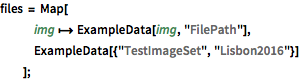
files = Map[
   img \[Function] ExampleData[img, "FilePath"],
   ExampleData[{"TestImageSet", "Lisbon2016"}]
   ];
Gather all the information required in an association.
In[2]:=
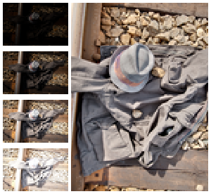
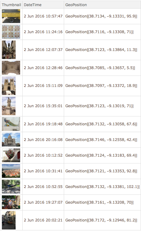
labels = {"Thumbnail", "DateTime", "GeoPosition"};In[3]:=
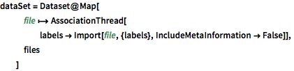
dataSet = Dataset@Map[
   file \[Function]
    AssociationThread[
     labels ->
      Import[file, {labels}, IncludeMetaInformation -> False]],
   files
   ]
Out[3]=
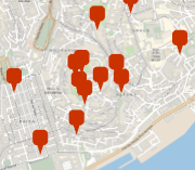
Visualize locations where images where taken.
In[4]:=
gps = dataSet[[All, "GeoPosition"]];
GeoGraphics[GeoMarker@gps, GeoRangePadding -> Quantity[100, "Meters"]]
Out[4]=
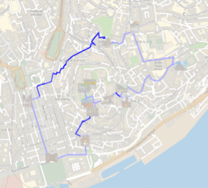
Compute the walking distance to take all pictures and return.
In[5]:=
closeLoop = path \[Function] Append[path, First[path]];In[6]:=
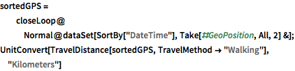
sortedGPS =
  closeLoop@
   Normal@dataSet[SortBy["DateTime"], Take[#GeoPosition, All, 2] &];
UnitConvert[
 TravelDistance[sortedGPS, TravelMethod -> "Walking"], "Kilometers"]
Out[6]=
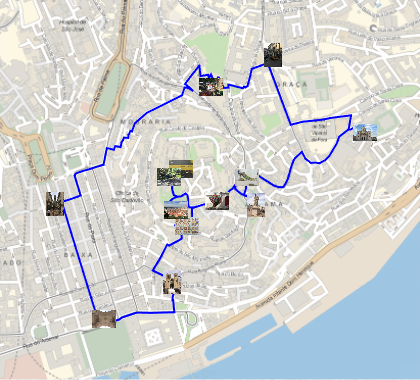
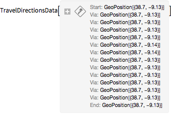
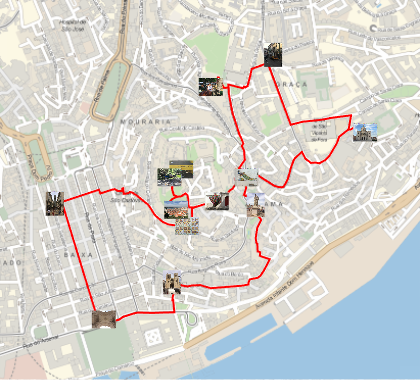
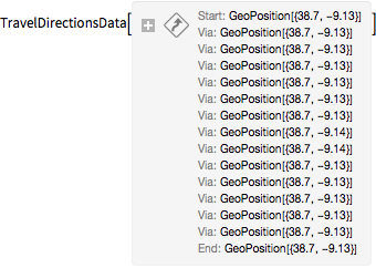
Visualize the path to take all photos in temporal order.
In[7]:=
travel = TravelDirections[sortedGPS, TravelMethod -> "Walking"]Out[8]=
In[9]:=
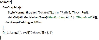
Animate[
 GeoGraphics[{
   Style[Normal@travel["Dataset"][1 ;; n, "Path"], Thick, Red],
   dataSet[All,
    GeoMarker[Take[#GeoPosition, All, 2], #Thumbnail] &]},
  GeoRangePadding -> Quantity[200, "Meters"]
  ],
 {n, 1, Length[travel["Dataset"]] + 1, 1}
 ]
Compute and visualize the shortest path that could have been used instead.
In[10]:=
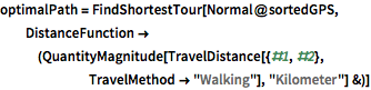
optimalPath =
 FindShortestTour[Normal@sortedGPS,
  DistanceFunction -> (QuantityMagnitude[
      TravelDistance[{#1, #2}, TravelMethod -> "Walking"],
      "Kilometer"] &)]
Out[10]=
In[11]:=
Quantity[First@optimalPath, "Kilometers"]Out[11]=
In[12]:=
shortestGPS = sortedGPS[[Last@optimalPath]];In[13]:=
shortestTravel =
 TravelDirections[shortestGPS, TravelMethod -> "Walking"]
Out[14]=
In[15]:=
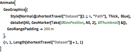
Animate[
 GeoGraphics[{
   Style[Normal@shortestTravel["Dataset"][1 ;; n, "Path"], Thick,
    Blue],
   dataSet[All,
    GeoMarker[Take[#GeoPosition, All, 2], #Thumbnail] &]},
  GeoRangePadding -> Quantity[200, "Meters"]
  ],
 {n, 1, Length[shortestTravel["Dataset"]] + 1, 1}
 ]