通过图像元数据对行程作分析
利用照片及其元数据,可以通过地理计算来分析和可视化葡萄牙里斯本的一次徒步旅行.
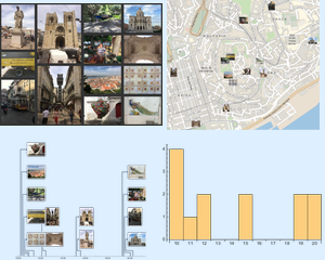
导入并分析旅行期间拍摄的照片集.
In[1]:=
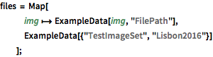
files = Map[
   img \[Function] ExampleData[img, "FilePath"],
   ExampleData[{"TestImageSet", "Lisbon2016"}]
   ];
收集一个关联中所需的所有信息.
In[2]:=
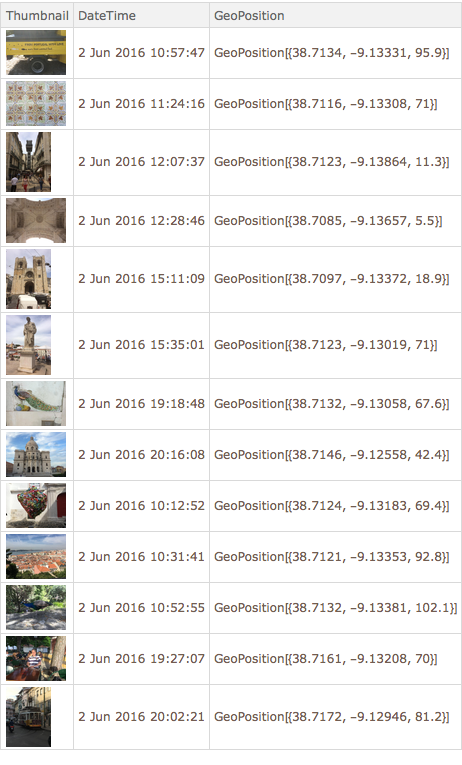
labels = {"Thumbnail", "DateTime", "GeoPosition"};In[3]:=

dataSet = Dataset@Map[
   file \[Function]
    AssociationThread[
     labels ->
      Import[file, {labels}, IncludeMetaInformation -> False]],
   files
   ]
Out[3]=
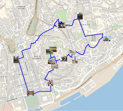
图示图片拍摄的位置.
In[4]:=
gps = dataSet[[All, "GeoPosition"]];
GeoGraphics[GeoMarker@gps, GeoRangePadding -> Quantity[100, "Meters"]]
Out[4]=

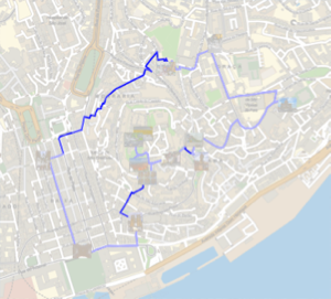
计算拍摄所有照片并返回所经过的步行距离.
In[5]:=
closeLoop = path \[Function] Append[path, First[path]];In[6]:=
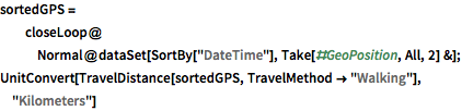
sortedGPS =
  closeLoop@
   Normal@dataSet[SortBy["DateTime"], Take[#GeoPosition, All, 2] &];
UnitConvert[
 TravelDistance[sortedGPS, TravelMethod -> "Walking"], "Kilometers"]
Out[6]=
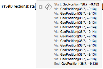
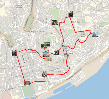
按时间顺序,将拍摄所有照片所经过的路径可视化.
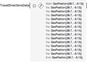
In[7]:=
travel = TravelDirections[sortedGPS, TravelMethod -> "Walking"]Out[8]=
In[9]:=
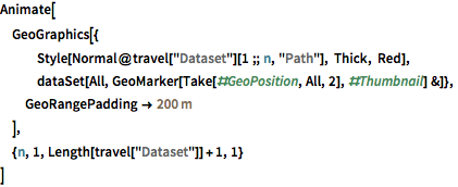
Animate[
 GeoGraphics[{
   Style[Normal@travel["Dataset"][1 ;; n, "Path"], Thick, Red],
   dataSet[All,
    GeoMarker[Take[#GeoPosition, All, 2], #Thumbnail] &]},
  GeoRangePadding -> Quantity[200, "Meters"]
  ],
 {n, 1, Length[travel["Dataset"]] + 1, 1}
 ]
计算并图示本来可以使用的最短路径.
In[10]:=
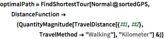
optimalPath =
 FindShortestTour[Normal@sortedGPS,
  DistanceFunction -> (QuantityMagnitude[
      TravelDistance[{#1, #2}, TravelMethod -> "Walking"],
      "Kilometer"] &)]
Out[10]=
In[11]:=
Quantity[First@optimalPath, "Kilometers"]Out[11]=
In[12]:=
shortestGPS = sortedGPS[[Last@optimalPath]];In[13]:=
shortestTravel =
 TravelDirections[shortestGPS, TravelMethod -> "Walking"]
Out[14]=
In[15]:=
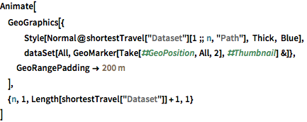
Animate[
 GeoGraphics[{
   Style[Normal@shortestTravel["Dataset"][1 ;; n, "Path"], Thick,
    Blue],
   dataSet[All,
    GeoMarker[Take[#GeoPosition, All, 2], #Thumbnail] &]},
  GeoRangePadding -> Quantity[200, "Meters"]
  ],
 {n, 1, Length[shortestTravel["Dataset"]] + 1, 1}
 ]