이미지의 메타 데이터를 통한 여행 분석
사진과 메타 데이터를 사용하여 포르투갈 리스본의 도보 투어를 시각화하고 분석하는 지리 계산을 할 수 있습니다.
리스본 여행 중에 찍은 사진을 가져와 분석합니다.
In[1]:=
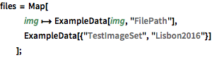
files = Map[
img \[Function] ExampleData[img, "FilePath"],
ExampleData[{"TestImageSet", "Lisbon2016"}]
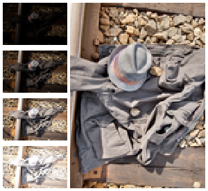
];연상에 필요한 모든 정보를 모아봅니다.
In[2]:=
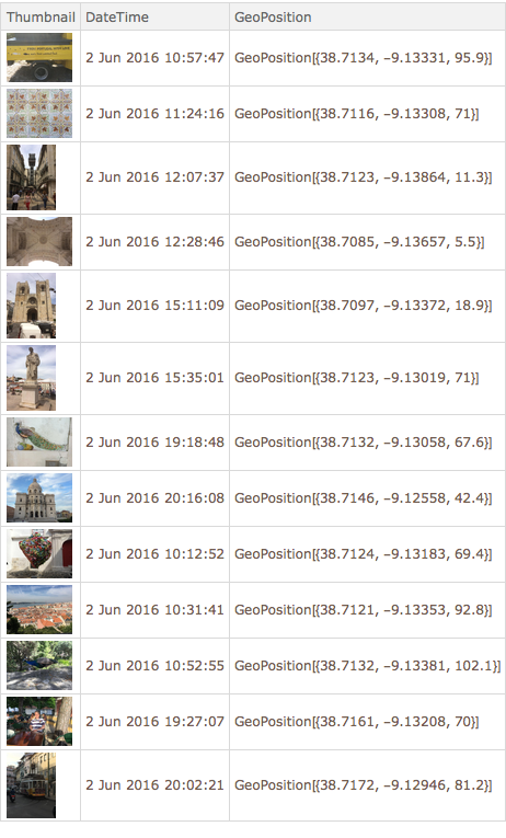
labels = {"Thumbnail", "DateTime", "GeoPosition"};In[3]:=
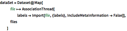
dataSet = Dataset@Map[
   file \[Function]
    AssociationThread[
     labels ->
      Import[file, {labels}, IncludeMetaInformation -> False]],
   files
   ]
Out[3]=
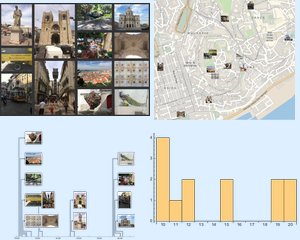
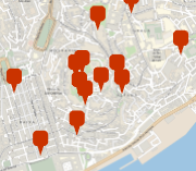
사진을 찍은 장소를 시각화합니다.
In[4]:=
gps = dataSet[[All, "GeoPosition"]];
GeoGraphics[GeoMarker@gps, GeoRangePadding -> Quantity[100, "Meters"]]
Out[4]=
모든 사진을 찍고 돌아갈 때까지의 보행 거리를 계산합니다.
In[5]:=
closeLoop = path \[Function] Append[path, First[path]];In[6]:=
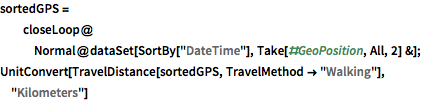
sortedGPS =
  closeLoop@
   Normal@dataSet[SortBy["DateTime"], Take[#GeoPosition, All, 2] &];
UnitConvert[
 TravelDistance[sortedGPS, TravelMethod -> "Walking"], "Kilometers"]
Out[6]=
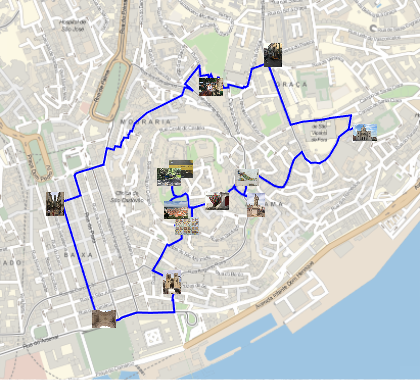
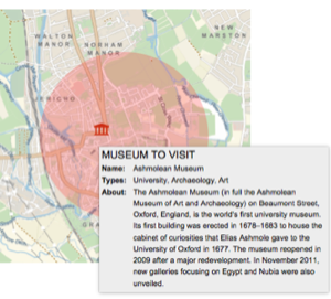
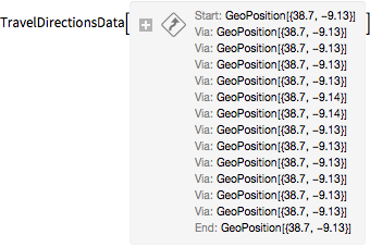
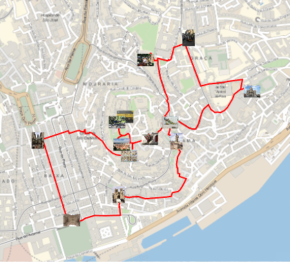
시간의 순서대로 모든 사진을 찍은 경로를 시각화합니다.
In[7]:=
travel = TravelDirections[sortedGPS, TravelMethod -> "Walking"]Out[8]=
In[9]:=
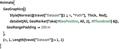
Animate[
 GeoGraphics[{
   Style[Normal@travel["Dataset"][1 ;; n, "Path"], Thick, Red],
   dataSet[All,
    GeoMarker[Take[#GeoPosition, All, 2], #Thumbnail] &]},
  GeoRangePadding -> Quantity[200, "Meters"]
  ],
 {n, 1, Length[travel["Dataset"]] + 1, 1}
 ]
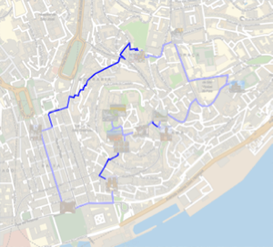
대체할 수 있는 최단 경로를 계산하고 시각화합니다.
In[10]:=
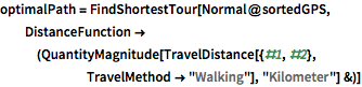
optimalPath =
 FindShortestTour[Normal@sortedGPS,
  DistanceFunction -> (QuantityMagnitude[
      TravelDistance[{#1, #2}, TravelMethod -> "Walking"],
      "Kilometer"] &)]
Out[10]=
In[11]:=
Quantity[First@optimalPath, "Kilometers"]Out[11]=
In[12]:=
shortestGPS = sortedGPS[[Last@optimalPath]];In[13]:=
shortestTravel =
 TravelDirections[shortestGPS, TravelMethod -> "Walking"]
Out[14]=
In[15]:=
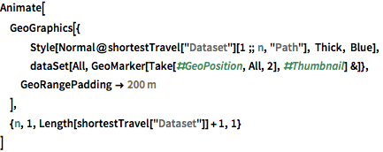
Animate[
 GeoGraphics[{
   Style[Normal@shortestTravel["Dataset"][1 ;; n, "Path"], Thick,
    Blue],
   dataSet[All,
    GeoMarker[Take[#GeoPosition, All, 2], #Thumbnail] &]},
  GeoRangePadding -> Quantity[200, "Meters"]
  ],
 {n, 1, Length[shortestTravel["Dataset"]] + 1, 1}
 ]