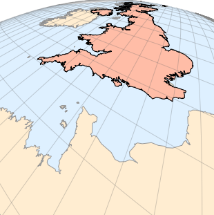
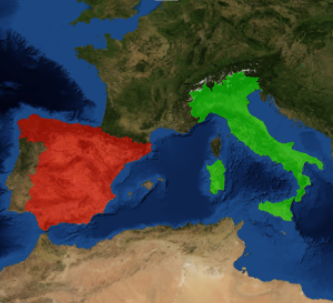
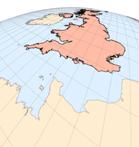
傾斜透視図法で可視化する
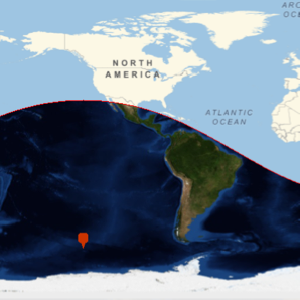
これは,イギリス海峡上の点を中心として傾斜透視図法を使って表した英国の地図である.高さ0.025は地球の半径と相対的なものであり,角度−30と20でカメラの向きが決まる.
In[1]:=
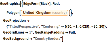
GeoGraphics[{EdgeForm[Black], Red,
  Polygon[Entity["Country", "UnitedKingdom"]]},
 GeoProjection -> {"TiltedPerspective",
   "Centering" -> {{50, -1, 0.025}, -30, 20}},
 GeoGridLines -> Quantity[1, "AngularDegrees"],
 GeoRangePadding -> Full, GeoBackground -> "CountryBorders"]
Out[1]=