New Tiles for Mars and Pluto
Version 11 adds an improved set of tiles for Mars and Pluto. This example demonstrates the new set of tiles for Mars.
Take one of the probes that have landed on Mars.
In[1]:=
probe = Entity["DeepSpaceProbe", "MarsScienceLaboratory"];In[2]:=
{probe["LaunchSite"], probe["LaunchDate"], probe["ArrivalDate"]}Out[2]=
In[3]:=
probe["Image"]Out[3]=

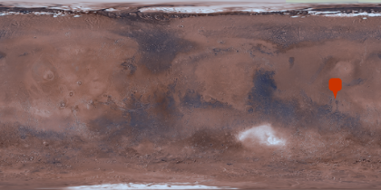
This is the location of the landing site in an equirectangular map of Mars of zoom level 1.
In[4]:=
GeoGraphics[GeoMarker[probe], GeoRange -> All]Out[4]=

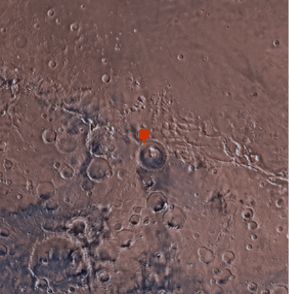
Increase the zoom level manually to 4.
In[5]:=
GeoGraphics[GeoMarker[probe], GeoZoomLevel -> 4]Out[5]=

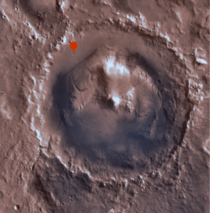
Increase even further, now centering the image at the Gale Crater.
In[6]:=

GeoGraphics[GeoMarker[probe], GeoZoomLevel -> 4];
Show[%, GeoCenter -> Entity["SolarSystemFeature", "GaleMars"],
 GeoRange -> Quantity[100, "Kilometers"]]
Out[6]=


