查看地震分布
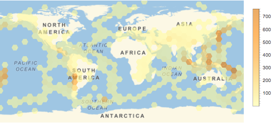
绘制 10 年间世界各地的地震频率图.
In[1]:=

events = Quiet@
   EarthquakeData[All,
     5, {DateObject[{2006, 1, 1}], DateObject[{2015, 12, 31}]},
     "Position"]["Values"];
In[2]:=
GeoHistogram[events, 50, GeoRange -> "World",
 PlotLegends -> Automatic, ImageSize -> 500]
Out[2]=

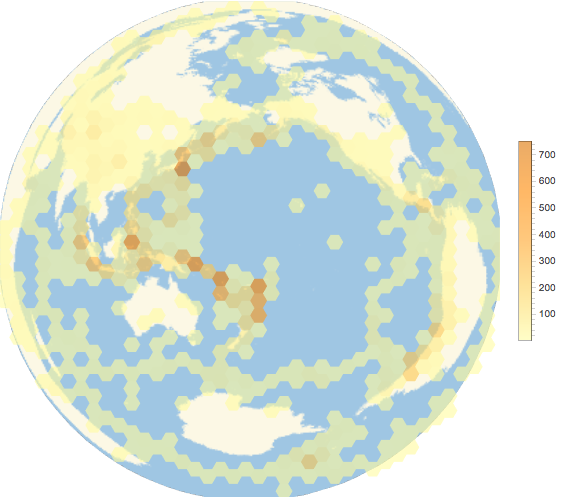
朗伯方位投影是保持面积不变的,所以所有的六边形都表示地球上相同的表面积. 这里,地图的中心为地震频发的环太平洋火山带(火环)的中心.
In[3]:=

GeoHistogram[events, 40, GeoRange -> "World",
 PlotLegends -> Automatic,
 GeoProjection -> {"LambertAzimuthal",
   "Centering" -> GeoPosition[{0, 180}]}, ImageSize -> 500]
Out[3]=


