지진의 분포 보기
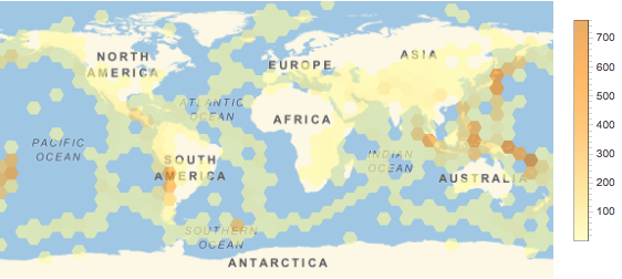
지난 10년간 세계에서 일어난 지진의 빈도를 플롯합니다.
In[1]:=

events = Quiet@
   EarthquakeData[All,
     5, {DateObject[{2006, 1, 1}], DateObject[{2015, 12, 31}]},
     "Position"]["Values"];
In[2]:=
GeoHistogram[events, 50, GeoRange -> "World",
 PlotLegends -> Automatic, ImageSize -> 500]
Out[2]=

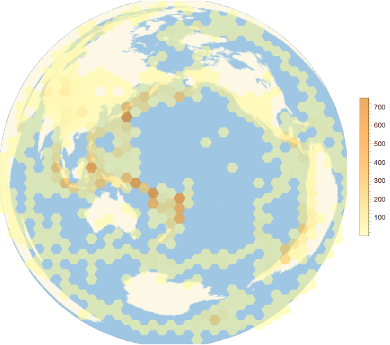
람베르트 정적 방위 도법은 면적을 올바르게 유지하여 표시되므로 모든 육각형은 지구상의 표면적을 동일하게 나타냅니다. 여기에서 지도는 세계 지진의 대부분이 발생하는 환태평양 조산대의 중심의 위치를 보여줍니다.
In[3]:=

GeoHistogram[events, 40, GeoRange -> "World",
 PlotLegends -> Automatic,
 GeoProjection -> {"LambertAzimuthal",
   "Centering" -> GeoPosition[{0, 180}]}, ImageSize -> 500]
Out[3]=


