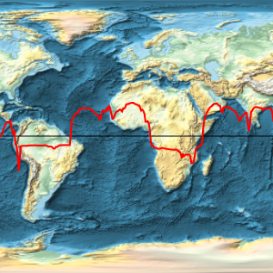
地图地理投影
版本 11 提供了数百种可用于球形和椭圆形参考模型的地图投影集锦. 它们可以用不同方式分类,在此我们来探索其中几种投影的范例.
In[1]:=
worldmap[proj_] := Framed[Labeled[
   GeoGraphics["World", GeoBackground -> "Satellite",
    GeoProjection -> proj, GeoGridLines -> Automatic,
    GeoGridLinesStyle -> Directive[White, Opacity[0.25]]],
   proj]]
圆柱投影.
In[2]:=
worldmap /@ {"Balthasart", "Mercator", "BSAMCylindrical",
  "CylindricalEqualArea"}
Out[2]=
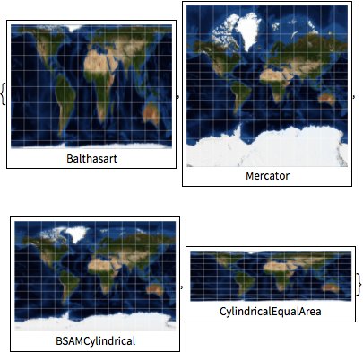
伪圆柱投影.
In[3]:=
worldmap /@ {"WinkelTripel", "Mollweide", "EckertI",
  "FoucautStereographic"}
Out[3]=
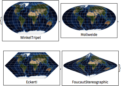
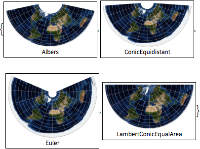
圆锥投影.
In[4]:=
worldmap /@ {"Albers", "ConicEquidistant", "Euler",
  "LambertConicEqualArea"}
Out[4]=
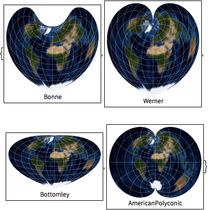
伪圆锥和多圆锥投影.
In[5]:=
worldmap /@ {"Bonne", "Werner", "Bottomley", "AmericanPolyconic"}Out[5]=
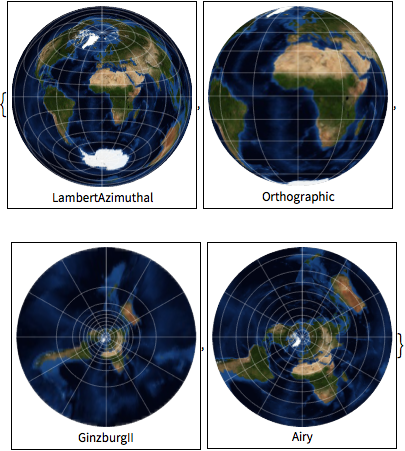
方位投影.
In[6]:=
worldmap /@ {"LambertAzimuthal", "Orthographic", "GinzburgII", "Airy"}Out[6]=
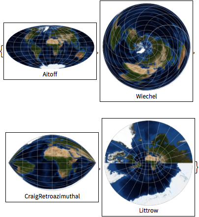
调整的方位投影和反方位投影.
In[7]:=
worldmap /@ {"Aitoff", "Wiechel", "CraigRetroazimuthal", "Littrow"}Out[7]=
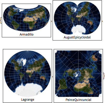
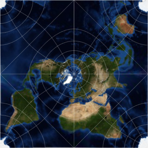
其他投影.
In[8]:=
worldmap /@ {"Armadillo", "AugustEpicycloidal", "Lagrange",
  "PeirceQuincuncial"}
Out[8]=