Neue Kacheln für den Mond
Version 11 bietet verbesserte Kacheln für den Mond, mit Zoomfähigkeit von 1 bis 9.
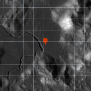
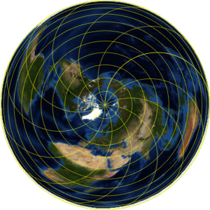
Dies ist die Position des Landeplatzes der Apollo 15-Mission.
In[1]:=
landing =
 Entity["MannedSpaceMission", "Apollo15"][
  EntityProperty["MannedSpaceMission", "LandingPosition"]]
Out[1]=
Plotten Sie eine geographische Markierung auf einer orthographischen Karte der erdzugewandten Seite des Mondes.
In[2]:=
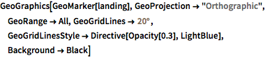
GeoGraphics[GeoMarker[landing], GeoProjection -> "Orthographic",
 GeoRange -> All, GeoGridLines -> Quantity[20, "AngularDegrees"],
 GeoGridLinesStyle -> Directive[Opacity[0.3], LightBlue],
 Background -> Black]
Out[2]=
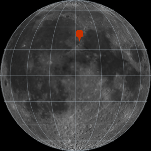
Der Landeplatz befindet sich in der Nähe des östlichen Rands des Mare Imbrium.
In[3]:=
GeoGraphics[GeoMarker[landing], GeoProjection -> "Orthographic",
 GeoRange -> All, GeoGridLines -> Quantity[20, "AngularDegrees"],
 GeoGridLinesStyle -> Directive[Opacity[0.3], LightBlue],
 Background -> Black];
Show[%, GeoRange -> Quantity[200, "Miles"],
 GeoGridLines -> Quantity[2, "AngularDegrees"]]
Out[3]=
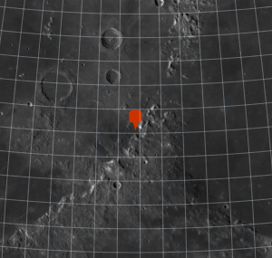
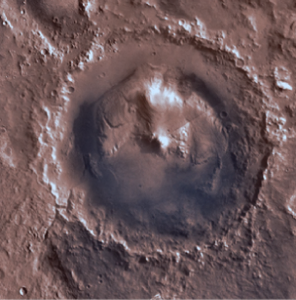
Zoomen Sie die Landestelle heran.
In[4]:=
landing =
 Entity["MannedSpaceMission", "Apollo15"][
  EntityProperty["MannedSpaceMission", "LandingPosition"]];
Show[%, GeoRange -> Quantity[200, "Miles"],
 GeoGridLines -> Quantity[2, "AngularDegrees"]];
Show[%, GeoRange -> Quantity[15, "Miles"],
 GeoGridLines -> Quantity[.2, "AngularDegrees"]]
Out[4]=