投影法による面積のひずみ
メルカトル図法では面積は正しく表示されない.これは正積図法ではない.
In[1]:=
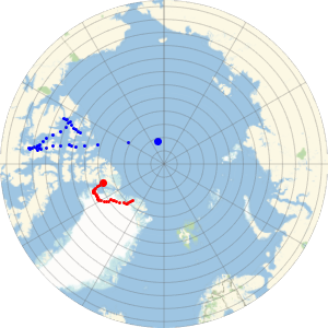
GeoProjectionData["Mercator", "EqualArea"]Out[1]=
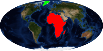
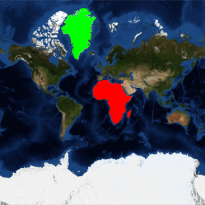
アフリカの面積はグリーンランドの面積の14倍を超える大きさである.
In[2]:=
GeoArea[Entity["GeographicRegion", "Africa"]]/
 GeoArea[Entity["Country", "Greenland"]]
Out[2]=
しかし,メルカトル図法では,アフリカとグリーンランドがほとんど同じ大きさに見える.
In[3]:=
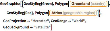
GeoGraphics[{GeoStyling[Green],
  Polygon[Entity["Country", "Greenland"]], GeoStyling[Red],
  Polygon[Entity["GeographicRegion", "Africa"]]},
 GeoProjection -> "Mercator", GeoRange -> "World",
 GeoBackground -> "Satellite"]
Out[3]=

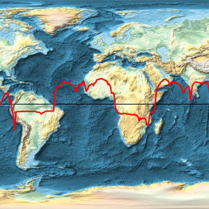
モルワイデ図法のような正積図法を使うと,相対的な大きさがより適切に表せる.
In[4]:=
GeoProjectionData["Mollweide", "EqualArea"]Out[4]=
In[5]:=
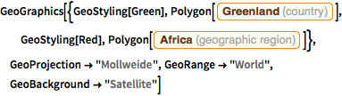
GeoGraphics[{GeoStyling[Green],
  Polygon[Entity["Country", "Greenland"]], GeoStyling[Red],
  Polygon[Entity["GeographicRegion", "Africa"]]},
 GeoProjection -> "Mollweide", GeoRange -> "World",
 GeoBackground -> "Satellite"]
Out[5]=