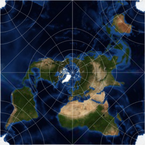
Distorção de área pela projeção
A projeção de Mercator não preserva áreas. Não é uma projeção de área equivalente.
In[1]:=
GeoProjectionData["Mercator", "EqualArea"]Out[1]=
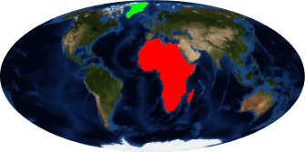
A área da África é mais do que 14 vezes maior que a área da Gronelândia.
In[2]:=
GeoArea[Entity["GeographicRegion", "Africa"]]/
 GeoArea[Entity["Country", "Greenland"]]
Out[2]=
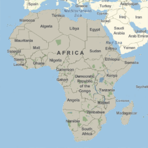
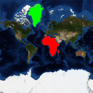
Em um mapa Mercator, no entanto, a África e a Gronelândia parecem ter tamanhos semelhantes.
In[3]:=
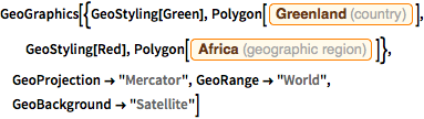
GeoGraphics[{GeoStyling[Green],
  Polygon[Entity["Country", "Greenland"]], GeoStyling[Red],
  Polygon[Entity["GeographicRegion", "Africa"]]},
 GeoProjection -> "Mercator", GeoRange -> "World",
 GeoBackground -> "Satellite"]
Out[3]=
Use uma projeção de área equivalente, como Mollweide, para representar mais adequadamente os tamanhos relativos.
In[4]:=
GeoProjectionData["Mollweide", "EqualArea"]Out[4]=
In[5]:=
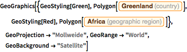
GeoGraphics[{GeoStyling[Green],
  Polygon[Entity["Country", "Greenland"]], GeoStyling[Red],
  Polygon[Entity["GeographicRegion", "Africa"]]},
 GeoProjection -> "Mollweide", GeoRange -> "World",
 GeoBackground -> "Satellite"]
Out[5]=