Polígonos con "HistoricalCountry"
El nuevo dominio de entidades geográficas "HistoricalCountry" proporciona datos útiles acerca de una gran colección de entidades históricas.
La extensión de tiempo del imperio romano.
In[1]:=
Entity["HistoricalCountry",
  "RomanEmpire"][{EntityProperty["HistoricalCountry", "StartDate"],
  EntityProperty["HistoricalCountry", "EndDate"]}]
Out[1]=
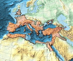
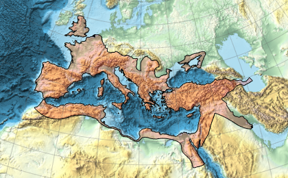
Ésta es la máxima extensión geográfica del imperio romano.
In[2]:=
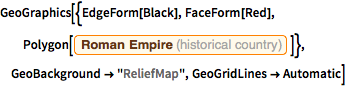
GeoGraphics[{EdgeForm[Black], FaceForm[Red],
  Polygon[Entity["HistoricalCountry", "RomanEmpire"]]},
 GeoBackground -> "ReliefMap", GeoGridLines -> Automatic]
Out[2]=
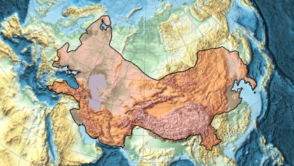
Y ésta es la máxima extensión del imperio mongol.
In[3]:=
Entity["HistoricalCountry",
  "MongolEmpire"][{EntityProperty["HistoricalCountry", "StartDate"],
  EntityProperty["HistoricalCountry", "EndDate"]}]
Out[3]=
In[4]:=
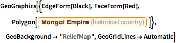
GeoGraphics[{EdgeForm[Black], FaceForm[Red],
  Polygon[Entity["HistoricalCountry", "MongolEmpire"]]},
 GeoBackground -> "ReliefMap", GeoGridLines -> Automatic]
Out[4]=