O Marciano
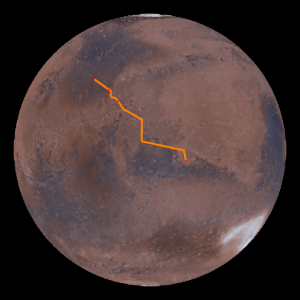
Calcule, represente e meça uma estimativa do caminho seguido por Mark Watney no livro "O Marciano", quando ele viajou de Ares 3 HAB até Ares 4 MAV.
Todas as posições neste exemplo referem-se a posições em Marte. Isso pode ser especificado explicitamente na GeoPosition, ou depois na opção GeoModel.
Estas são estimativas das posições dos desembarques em Ares 3 e 4 .
ares3 = GeoPosition[{31.2, -28.5}, "Mars"];
ares4 = GeoPosition[{-4.32, 15.28}, "Mars"];
Portanto, esta é a primeira aproximação da viagem de Mark em Marte.
GeoGraphics[{Orange, Thick, Arrow@GeoPath[{ares3, ares4}]},
 GeoRange -> All, GeoProjection -> "Orthographic",
 Background -> Black]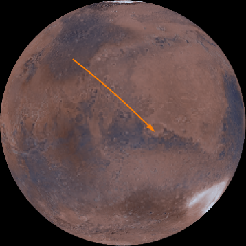
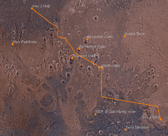
De Ares 3 HAB, Mark vai para Marth Vallis, um vale formado por água que ele segue.
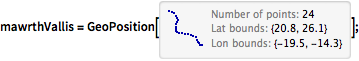
mawrthVallis = GeoPosition[CompressedData["
1:eJxTTMoPSmViYGCQAGIQLd/6OnCHnJXDN42Y/kOlxgdsua4vLvhr6QAkbbnE
jQ8wgMABS4d17g+rRNYZHZg1EwgiLaHqjQ5wgRVaOhz+ChRwMoKqt3BYAhS9
rmx0AKTLPdHCoRBksIHRgf5DQIX8Fg4iIANDjA5oAo35usLcAaLO6EDQDjmg
ixD8s2eAgMccrj4NBJ6Zwc0DK99h5vAmEMQyPACmV5s5gN3RYAixf6GZA8Re
wwNgdzbB5A0OGINAsZkDxB8GEPf5m0H8H64P9Z8ZxH+H9CDqN5tC/at3AOIu
U0h4fNWF2Kdo6uABYhzXhaj/bAL1jy5E/RUTB3A4ztQ5AAD2PaQO
"]];GeoGraphics[{Thick, Orange, Arrow@GeoPath[mawrthVallis]},
GeoModel -> "Mars", GeoRangePadding -> Quantity[100, "Miles"]]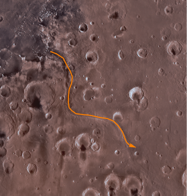
Depois Mark passa entre as crateras Trouvelot e Rutherford.
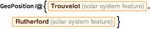
GeoPosition /@ {Entity["SolarSystemFeature", "TrouvelotMars"],
Entity["SolarSystemFeature", "RutherfordMars"]}rtCraters = GeoPosition[{17.52, -11.91}, "Mars"];E então ele viaja até a cratera Marth.
marthCrater = GeoPosition[Entity["SolarSystemFeature", "MarthMars"]]De lá ele viaja 540 kilometros para o sul.
pos540S =
 GeoDestination[marthCrater,
GeoDisplacement[{Quantity[540, "Kilometers"], "South"}]]E finalmente ele chega perto da cratera Schiaparelli.
schiaparelliCrater = GeoPosition[{-0.16, 14.38}, "Mars"]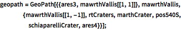
geopath =
  GeoPath[{{ares3, mawrthVallis[[1, 1]]},
    mawrthVallis, {mawrthVallis[[1, -1]], rtCraters, marthCrater,
     pos540S, schiaparelliCrater, ares4}}];
Este caminho geográfico tem a seguinte distância na superfície de Marte.
GeoLength[geopath, GeoModel -> "Mars"]Finalmente, adicione o número de lugares mencionados no livro, com as respectivas identificações.
labeled[pos_, label_, offset_: {Left, Bottom}] := {Point[pos],
  Text[Style[label, Directive[12, Italic, White]], pos, offset]}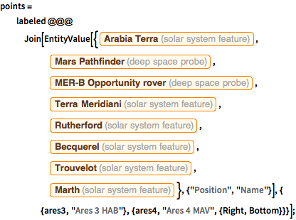
points = labeled @@@
   Join[EntityValue[{Entity["SolarSystemFeature", "ArabiaTerraMars"],
      Entity["DeepSpaceProbe", "MarsPathfinder"],
      Entity["DeepSpaceProbe", "MERDashBOpportunityRover"],
      Entity["SolarSystemFeature", "TerraMeridianiMars"],
      Entity["SolarSystemFeature", "RutherfordMars"],
      Entity["SolarSystemFeature", "BecquerelMars"],
      Entity["SolarSystemFeature", "TrouvelotMars"],
      Entity["SolarSystemFeature", "MarthMars"]}, {"Position",
      "Name"}], {
     {ares3, "Ares 3 HAB"}, {ares4, "Ares 4 MAV", {Right, Bottom}}}];
Este é o mapa final da viagem.
GeoGraphics[{Orange, Thick, geopath, PointSize[Large], points},
 GeoModel -> "Mars"]