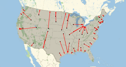
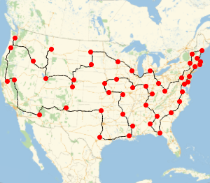
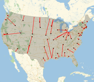
Le chemin le plus rapide vers la côte
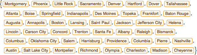
Trouvez le chemin le plus court possible pour atteindre un point de la frontière américaine à partir de chaque capitale des États américains limitrophes.
Prenez la liste des capitales.
In[1]:=

capitals =
 EntityValue[
  EntityClass["AdministrativeDivision", "ContinentalUSStates"],
  "CapitalCity"]
Out[1]=
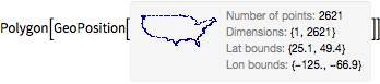
Prenez le polygone des États-Unis.
In[2]:=
us = EntityValue[Entity["Country", "UnitedStates"], "Polygon"]Out[2]=
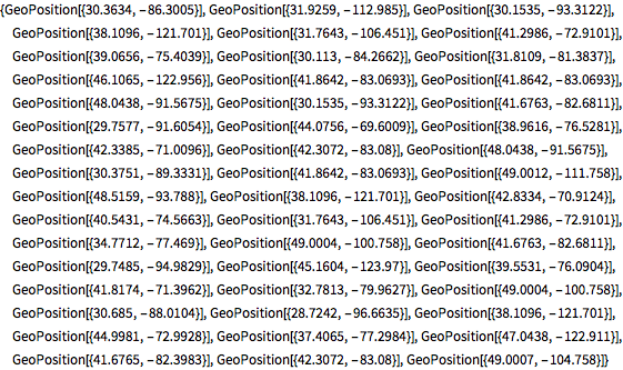
Calculez le point le plus proche de la limite du polygone pour chaque capitale d'État.
In[3]:=
borderpoints = Flatten[Nearest[First[us], GeoPosition[capitals]]]Out[3]=
Dessinez tous les chemins géodésiques.
In[4]:=
GeoGraphics[{us, Point[capitals], Red, Arrowheads[0.015],
  Arrow /@ GeoPath /@ Thread[{capitals, borderpoints}]}]
Out[4]=