Geodätische Kartenprojektionen
Die Wolfram Language bietet eine große Sammlung hunderter Kartenprojektionen, sowohl für Kugel- als auch für Ellipsoidreferenzmodelle. Sie können auf unterschiedliche Art eingeteilt werden, und in den folgenden Beispielen behandeln wir einige dieser Projektionstypen.
In[1]:=

worldmap[proj_] := Framed[Labeled[
   GeoGraphics["World", GeoBackground -> "Satellite",
    GeoProjection -> proj, GeoGridLines -> Automatic,
    GeoGridLinesStyle -> Directive[White, Opacity[0.25]]],
   proj]]
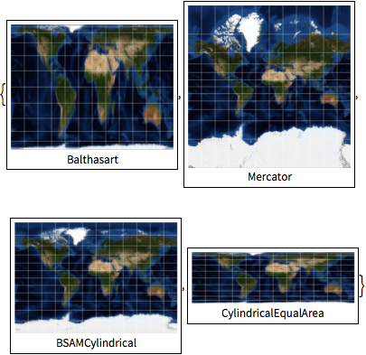
Zylinderprojektionen.
In[2]:=
worldmap /@ {"Balthasart", "Mercator", "BSAMCylindrical",
  "CylindricalEqualArea"}
Out[2]=
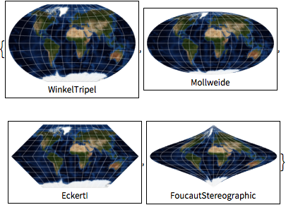
Pseudo-Zylinderprojektionen.
In[3]:=
worldmap /@ {"WinkelTripel", "Mollweide", "EckertI",
  "FoucautStereographic"}
Out[3]=
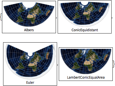
Kegelprojektionen.
In[4]:=
worldmap /@ {"Albers", "ConicEquidistant", "Euler",
  "LambertConicEqualArea"}
Out[4]=
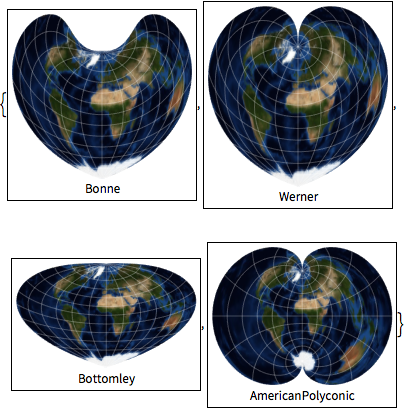
Pseudo-Kegelprojektionen und polykonische Projektionen.
In[5]:=
worldmap /@ {"Bonne", "Werner", "Bottomley", "AmericanPolyconic"}Out[5]=
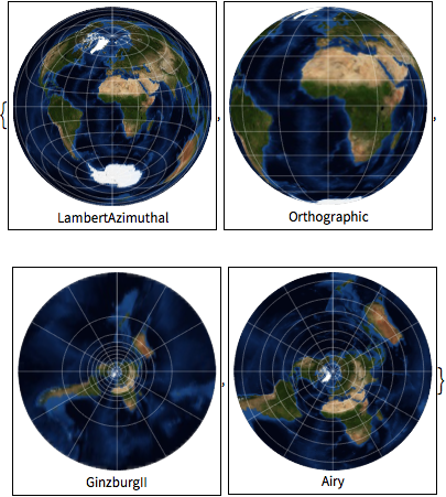
Azimutalprojektionen.
In[6]:=
worldmap /@ {"LambertAzimuthal", "Orthographic", "GinzburgII", "Airy"}Out[6]=
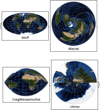
Modifizierte Azimutal- und Retroazimutalprojektionen.
In[7]:=
worldmap /@ {"Aitoff", "Wiechel", "CraigRetroazimuthal", "Littrow"}Out[7]=
Weitere Projektionen.
In[8]:=
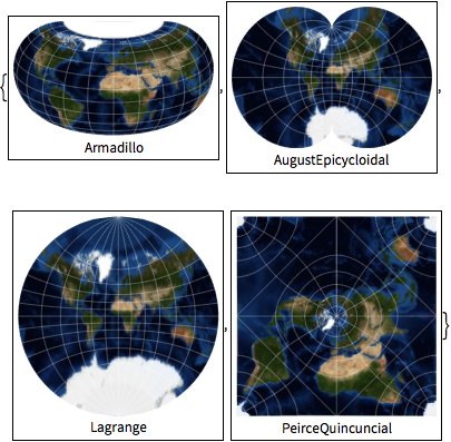
worldmap /@ {"Armadillo", "AugustEpicycloidal", "Lagrange",
  "PeirceQuincuncial"}
Out[8]=
